東北地方を中心としたプレートモデル等、構造に関する数値データをまとめました。
データを使用する場合は、出典論文を正確に明記するようにお願いします。
→繰り返し地震震源リスト等の数値データはこちら / 過去の大地震震源域等の数値データはこちら
|
● フィリピン海プレートの北東限の位置 | |
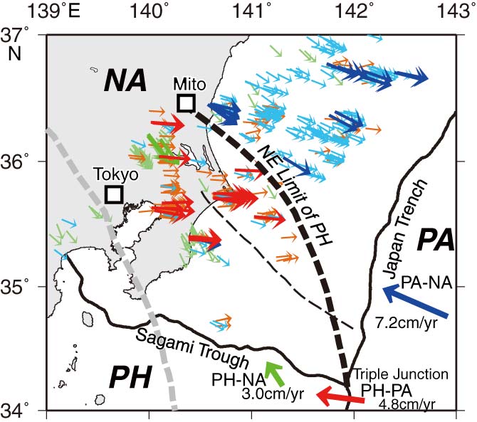 |
北東限の線の緯度経度データ EPSL2009NElimit.txt [0.4 KB] (図の黒太破線)
出典論文:Uchida, N., J. Nakajima, A. Hasegawa, and T. Matsuzawa, What controls interplate coupling?: Evidence for abrupt change in coupling across a border between two overlying plates in the NE Japan subduction zone, Earth Planet. Sci. Lett., 283, 111-121, 2009 |
|
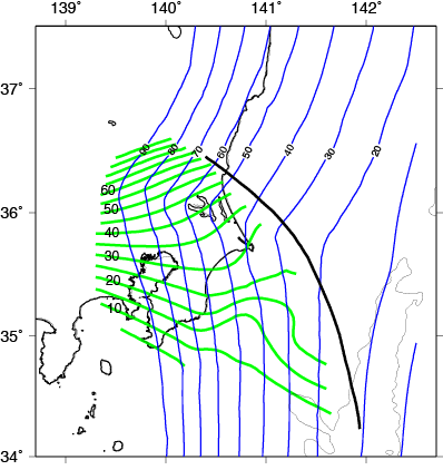
● 関東地方のフィリピン海プレート・太平洋プレートの形状 | |
|
フィリピン海プレート (緑色)Ito-Uchida_PHS.grd [20 KB] 太平洋プレート(青色) Nakajima-Uchida_PAC.grd [499 KB] (Hirose Fuyuki's HPにも関連データがあります。) 出典論文: [フィリピン海プレートの陸域・太平洋プレート] Uchida, N., T. Matsuzawa, J. Nakajima, and A. Hasegawa, Subduction of a wedge-shaped Philippine Sea plate beneath Kanto, central Japan, estimated from converted waves and small repeating earthquakes, J. Geophys. Res., 115(B07309), doi:10.1029/2009JB006962, 2010. |
|
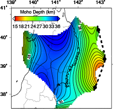
● 三陸沖のモホ面形状 | |
|
モホ面深さデータ sanrikuMoho.tar.gz [72 KB] 出典論文:Uchida, N., S. H. Kirby, T. Okada, R. Hino, and A. Hasegawa, Supraslab earthquake clusters above the subduction plate boundary offshore Sanriku, northeastern Japan: Seismogenesis in a graveyard of detached seamounts?, J. Geophys. Res., 115, doi:10.1029/2009JB006797, 2010. |
|
● 太平洋プレート上のプレート境界地震分布の深部限界 | |
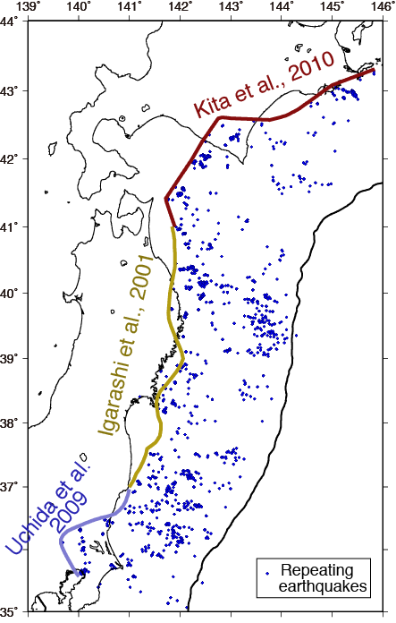 |
緯度・経度のデータ limit.tar.gz [0.7 KB] 出典論文: [東北] Igarashi, T., Matsuzawa, T., Umino, N., and Hasegawa, A., Spatial distribution of focal mechanisms for interplate and intraplate earthquakes associated with the subducting Pacific plate beneath the northeastern Japan arc: A triple‐planed deep seismic zone, J. Geophys. Res., 106( B2), 2177-2191, doi:10.1029/2000JB900386, 2001. [関東]: Uchida, N., J. Nakajima, A. Hasegawa, and T. Matsuzawa, What controls interplate coupling?: Evidence for abrupt change in coupling across a border between two overlying plates in the NE Japan subduction zone, Earth Planet. Sci. Lett., 283, 111-121, 2009. |